5-0-3
Release 5-0-3
In this release, we introduce a new feature and an enhancement to an existing feature.
1. Geofence Tagging:
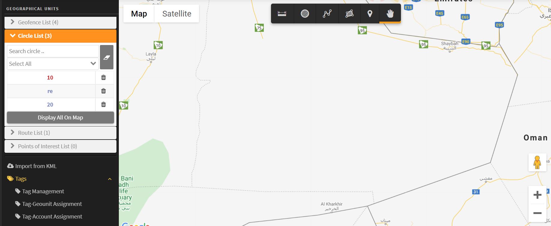
We enhanced the geographical units feature in our platform to provide more flexibility and organizability. The enhancement affects each part in the system that introduces geofences selection or filtering.
Now the company admin can tag the geofences with a special tag -in mean of grouping the geofences- for mor convenient usability. Geofence tagging makes it possible to prevent clients accounts from watching geofences that they should not watch. The main utility of geofence tagging can be summarized by:
-
- Coloring geofences
- Search for geofences by tags
- Limiting access to geofences according to the assigned tags
to get advantage from geofence tagging, the following steps should be followed:
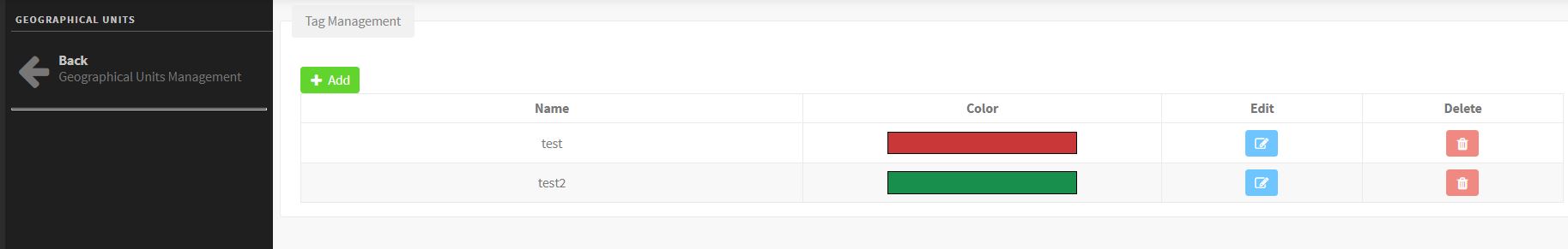
Tag Management:
On the geographical units page, click on the “Tags” menu then open the “Tag management” page.
On the tag management page, you can add your own tags that will be assigned to the geofences. You can customize your tags with different colors to distinguish between your geofences as you will see in the next steps.
Tag-Geounits Assignment
Under the “Tag” menu, open the “Tag-Geounits Assignment” page to assign the tags you previously created to the geofences.
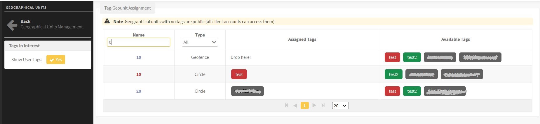
Here you’ll find that each client account has an automatically created tag that can’t be deleted. You can only hide them using the option “show users tags” at the sidebar on this page.
Now, you can distribute the tags over the geofences as suits your requirements considering that:
-
- Each geofence will be shown for the accounts that have any of the tags it has.
- Each client account has a default tag named by the owner’s name of this account. this tag can be assigned to a geofence so that this geofence will be shown for the account.
- Each geofence with no tags assigned will be considered as a public geofence that all clients’ accounts can see.
- A geofence with only one colored tag will be colored by the same color of the tag. If a geofence has two different colored tag, it won’t be colored by any of them.
Tag-Account Assignment
Under the “Tag” menu, open the “Tag-Account Assignment” page to assign the tags you previously created to the accounts.
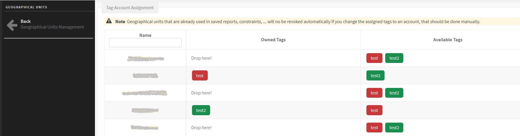
Here, the clients’ accounts’ tags won’t be displayed as they are already assigned to their accounts. Only the tags that can be assigned to the accounts will be displayed.
Now, you can distribute the tags over the accounts considering that:
-
- Each account with a tag “T for example” can see all geofences that have the tag “T”
- Each account can see the geofences that have its own tags.
- When the company admin revokes users/tags, saved alarm cond and reports won’t be affected
After you create your own tags and tag your geofences, you will be able to benefit from the tagging (colored geofences, search by tag, limited access according to the assigned tags) in all system pages that introduce any geofences operations.
Pages Affected by geofence tagging:
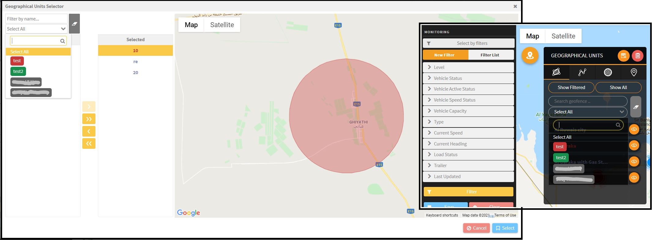
All geofences’ filters in the platform now support searching for geofences by their tags and display the geofences colored by their tags’ colors if the points mentioned earlier apply. In the following, we list the pages that have the geofence tagging pros
o Geographical Units page
o Monitoring (geofence panel)
o Path history (geofence panel)
o JMS bronze conditions and waypoints/stops
o TRIPs module
o Main dashboard (geofence chart)
o Alarm page: Vehicle ownership overrides geofence permitted tag. i.e. the user can view the alarm details of an alarm of one of its vehicles even if it contains geofences he is not allowed to view.
o Alarm conditions
o All geofence related reports
N.B. In alarm conditions and reports, the user can filter the appeared geofence by tag to ease their selection. However, the input shall remain as geofences and not tags.
⊗Important Notes
-
Geofences created by a user are visible by the creator and the company admin only.
-
The Company administrator has always the permission to view/manage all geofences despite their tags.
-
The company administrator (only) has a special page to manage tags and user permissions against the authorized geofences.
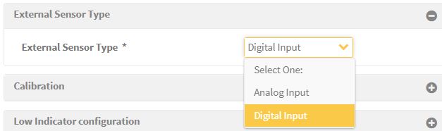
2. Digital Fuel Sensor
a new fuel source to the external sensor source is added. Now you can choose whether the sensor in-use is an analog sensor or a digital sensor. After choosing the digital sensor type, you need to add the calibration points just like the case of the analog sensor so the system can calculate the fuel level depending on the received readings.