5-1-2
Release 5-1-2
In this release, we introduce a new report and new features
1- Geofence-based Voyage report
In this report, we introduce a new concept, a new feature, and a new method of report generating. we extend the concept of Trip by allowing the user to partition vehicle movement based on geofence-based alarms. i.e., enter/exit one or more geofences. The results movement partitions form a new concept “we call it Voyage” where the start and end can be dynamically configured by the user based on predefined geofences.
Concepts related to Voyage:
Each voyage starts when a vehicle leaves the determined “start geofence” and ends when the vehicle returns back to it.
♦ If the vehicle passes through any geofence of the geofences monitored by the end criterion alarm instance (Destination alarm conditions), a sub-voyage will be displayed to provide information about the passed through geofence along with the entrance time to this geofence. The voyage start time will always be the same (the time when the vehicle leaves the start geofence)
♦ If the vehicle doesn’t pass through any geofence and returns back to the start geofence during the selected time range, nosub-voyage will be displayed, however, the overall voyage information will be displayed (start/end time, distance, etc.).
♦ If the vehicle doesn’t pass through any geofence and doesn’t return back to the start geofence during the selected time range, a validity expiry is applied. Validity expiry is a user-defined duration where the report will end a voyage if its duration exceeds the specified validity duration without returning back to the start geofence.
♦ The “total distance” is the distance traveled during the overall voyage (leaving the start geofence and returning back to it)
♦ The “distance” is the distance traveled between the starting geofence and one of the geofences of the end criterion.
Specifications:
-
The user can determine the start/end criteria of the fleet voyages. The user always chooses the start geofence and multiple end geofences acquired by the alarm condition instance of the “Destination alarm conditions”
-
This new report is built over the alarm conditions “enter/exit geofence” where the created instance is used per start/end criteria.
-
Alarm condition instance is mandatory for generating this report.
Report input:
-
Vehicle level
-
Date range
-
”Start condition” through the appropriate alarm condition instance
-
Start geofence
-
”End condition” through the appropriate alarm condition instance
-
Validity range
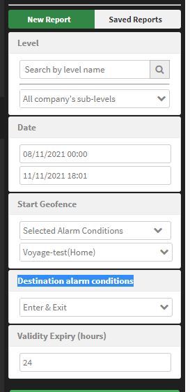
Report output:
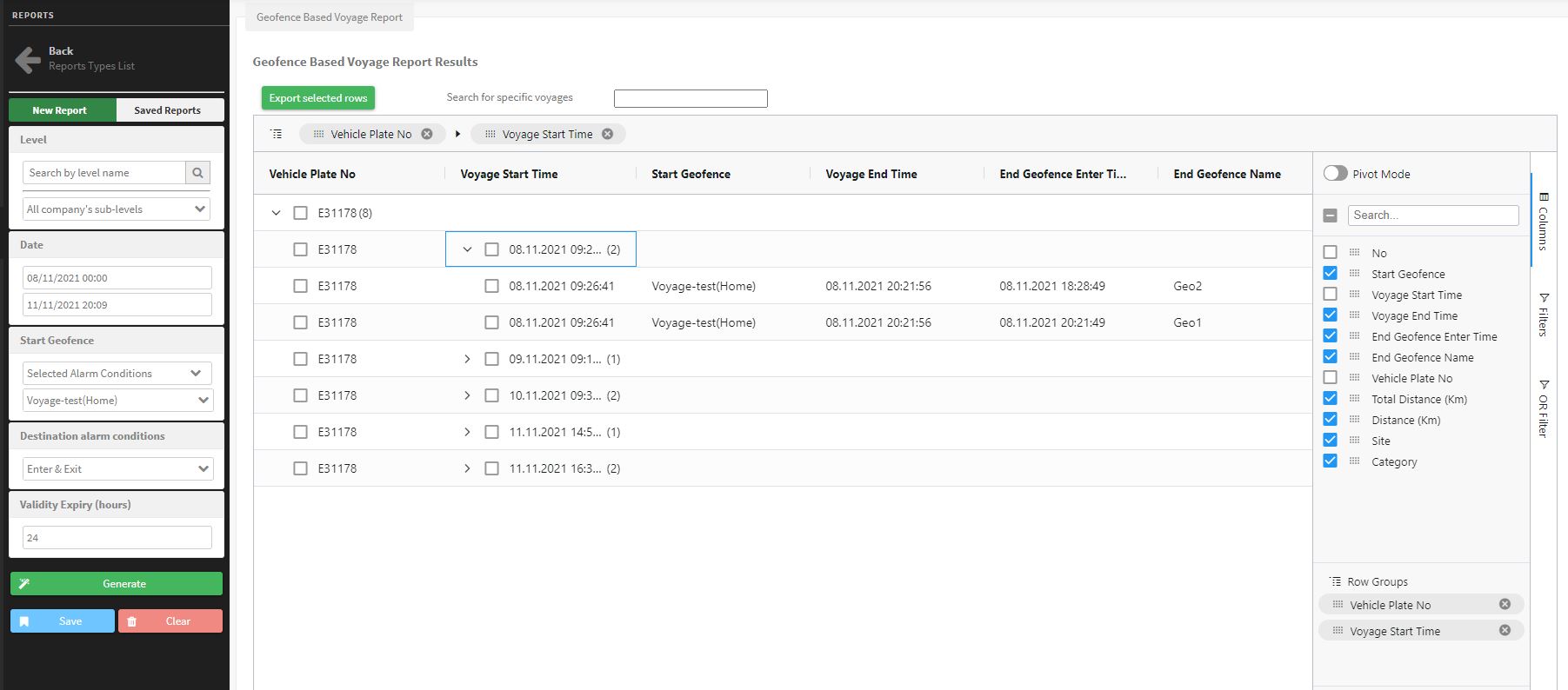
the report output is very rich and comprehensive. it introduces a new way full of versatility over our ordinary reports. it supports pivot mode with many available choices to give more flexibility in customizing your output.
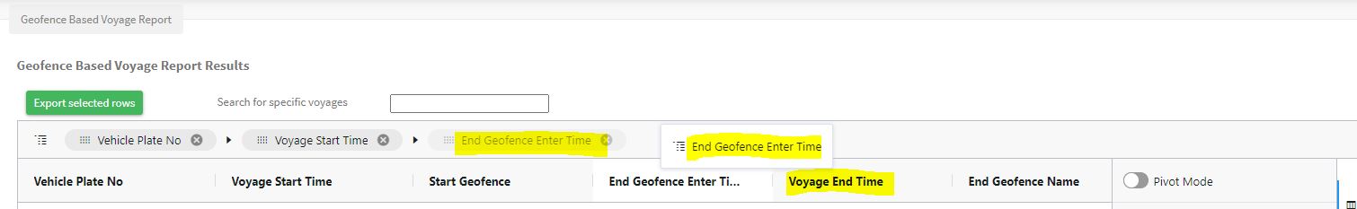
⇒ The report is grouped by default by the vehicle plate number and voyage start time. However, you still can group your report by any asset you need; all you need to do is to drag the column of you interest and drop it on the top bar, like in the picture.
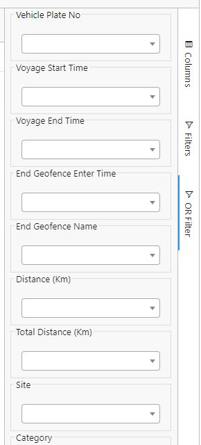
⇒ The report is equipped with advanced filters at the output. They notably enhance your experience with reports, Especially, the “OR” filter. it extends your report customization and, moreover, it enables you of searching for records when you are not sure about all parameters.
⇒ Above the top bar, you find a search box to search in the geofences at the output and an excel exporter to export any record you need by checking the checkbox next to the record.

⇒ Finally, you need to pay attention here that this report can’t be saved or scheduled.
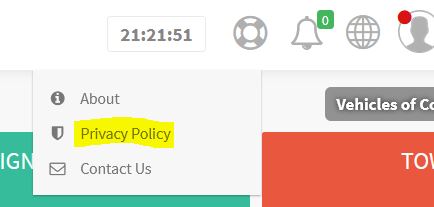
2- “EULA” acceptance
Now all new users should accept the End-User License agreement “EULA” before they can start using their accounts. Moreover, users can check their EULA anytime from their account like the following figure shows.
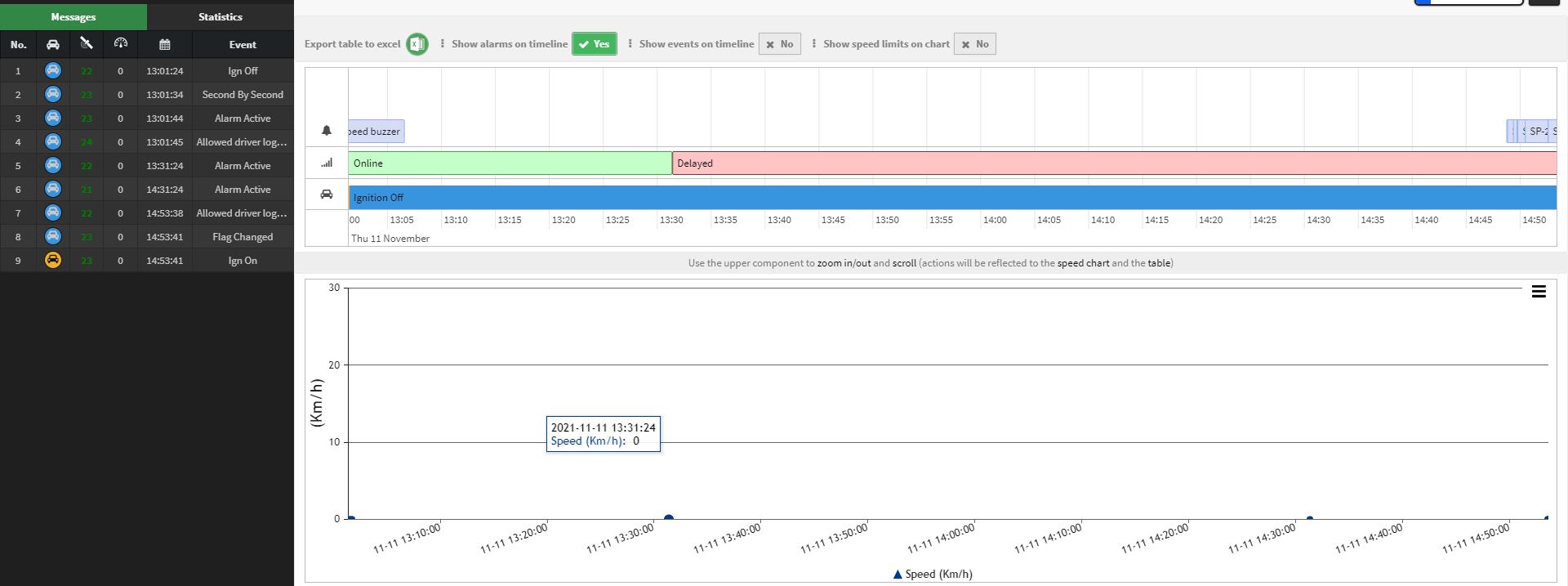
3- Vehicle Timeline
Now you can check the evolution of the vehicles’ paths against time in a comprehensive time chart. Furthermore, the chart shows the speed changes over time with the ability to show the speed limits -if any- on the chart.
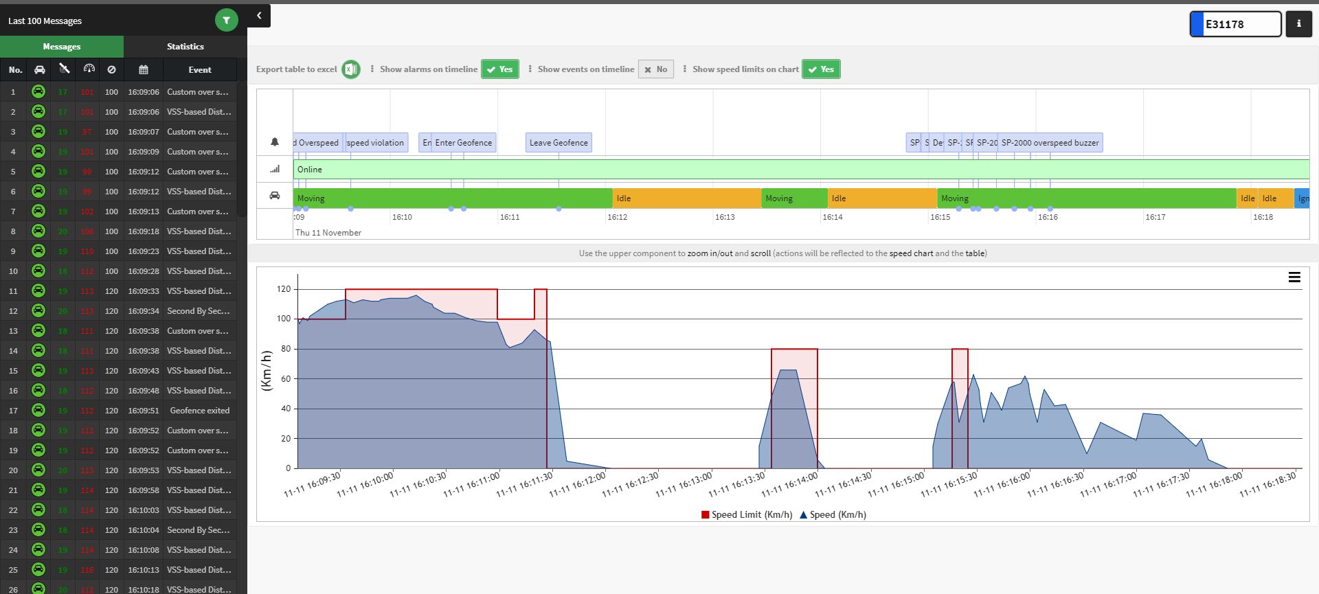
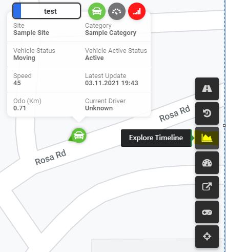
Just like the path history, you can reach the vehicle time line from the monitoring page by clicking on the time line icon.
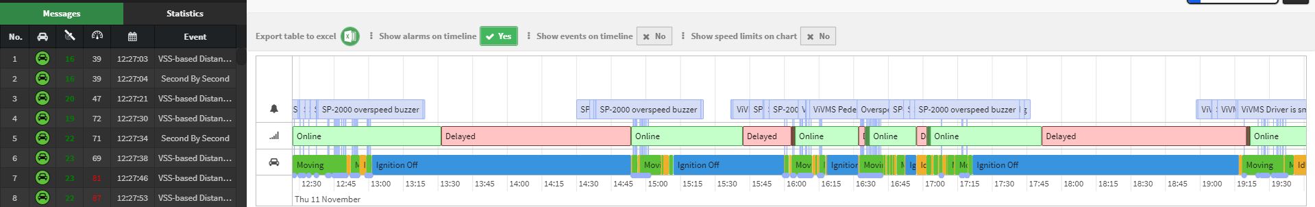
The system will open a timeline-based history for the vehicle rather than a map-based one. This history provides the same filters and statistics that the ordinary path history provide, plus, new options as follows:
>> You can export the messages table to an excel sheet
>> You can choose to show the alarms on the timeline
>> You can choose to the events on the timeline
>> You can choose to show the speed limit applied on the road — if any- on the speed chart. This speed limit is obtained from the Geo-Service we use.
>> On top of that, you can click on any event, alarm, or even a communication status from the table to zoom in on the messages of the clicked parameter.
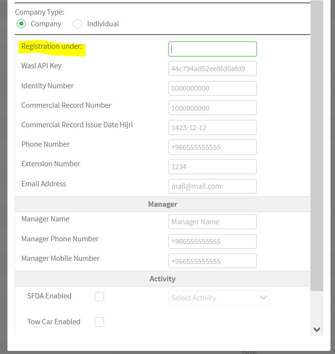
4. Multiple WASL reference key registration:
For WASL users only
It’s possible now to register the same company in the platform using multiple company references from WASL. You only need to enter the company reference in the registration page:
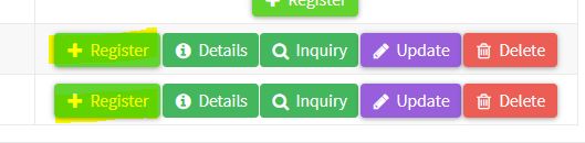
After registering the company under some reference, you still can register it under another one as shown below.
5. modules audit log
now all actions done on the modules are recorded in the audit log explorer.